Executive Summary
The Southwest Florida Regional Planning Council (SWFRPC) assisted the City of Bonita Springs in developing a Spring Creek Restoration Plan that included plans for restoration of hydrology, water quality, habitat, and navigation.
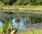
The Spring Creek Watershed is located in the southern area of Lee County. It is approximately ten (10) square miles in size. The watershed mouth originates at Estero Bay approximately 6,000 feet south of Coconut Road. The watershed is approximately two miles wide and five miles long. This watershed is generally located south of the Halfway Creek Watershed and north and west of the Imperial River Watershed.
In the development of this Vulnerability Assessment we met with the City of Bonita Springs staff to introduce the project and began discussions of previously identified and considered restoration needs, vulnerabilities and potential mitigations. We completed initial meetings with citizens at Cedar Creek, Imperial Harbor, Pelican Landing, and Spring Creek Village. We confirmed the scope of work, selected protocols, and confirmed accepted population projections for the watershed. We undertook data acquisition, continued meetings and fact-finding as needed, and coordinated data needs. We distributed and responded to all time-critical data requests, and set up and performed site visits for project assessments. We then applied the Regional Restoration Coordination Team, Southwest Florida Comprehensive Watershed Plan, and Southwest Florida Vulnerabilities Assessment to the watershed to identify vulnerabilities.